NWS Lake Charles tropical update: 4 p.m. 6.5.20
Published 4:46 pm Friday, June 5, 2020
|
Getting your Trinity Audio player ready...
|
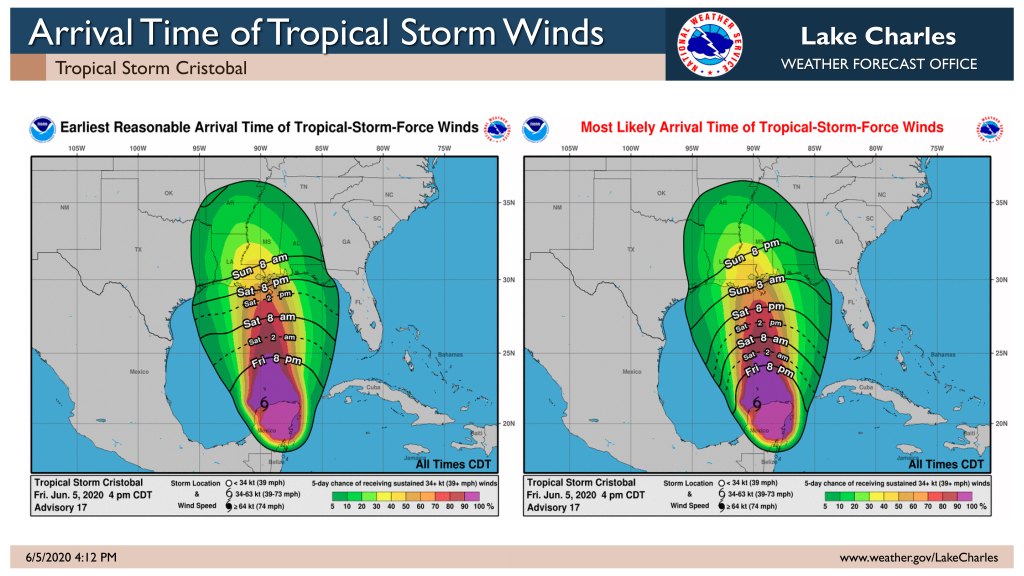
Cristobal is moving north at a quicker pace. Landfall has moved up to late Sunday afternoon or evening as a tropical storm in south central or southeast Louisiana.
Flooding is our top concern – from both storm surge and rainfall – in parts of south central Louisiana Sunday and Monday. We are expecting four to six inches of rain, with locally higher amounts. Tides are already running a foot above normal, and will rise further late this weekend.
Winds could be tropical storm force in parts of south central Louisiana. Expect scattered power outages Sunday and Monday.
Here are some breakdown numbers:
Rainfall: southeast Texas <1inch, southwest Louisiana 1-2 inches, central Louisiana 1-3 inches, south central Louisiana 2-6 inches..
Storm Surge: 1-3t AGL in lower parts of Vermilion, Iberia, lower St. Martin and St. Mary Parishes.
Tropical Storm Wind Probabilities: southeast Texas 10-20%, southwest Louisiana 20-40%, central Louisiana 20-40%, south central Louisiana 30-70%.


