UPDATE: Weather Service outlines damaging wind, potential for street flooding
Published 1:08 pm Wednesday, April 26, 2023
|
Getting your Trinity Audio player ready...
|
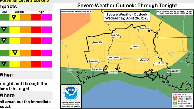
As of 3 p.m. Wednesday, the National Weather Service said the potential risk for severe weather increased for the overnight period (after midnight) to Slight (level 2 out of 5) for the entire area except the immediate coast.
Once again the main concern is bowing bands of storms producing damaging wind gusts greater than 60 mph.
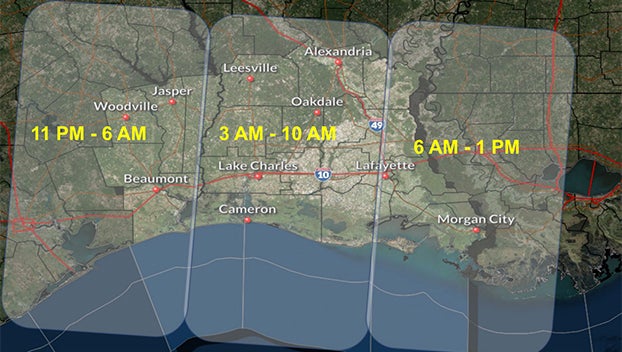
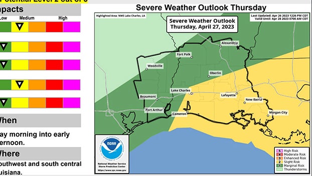
There is a potential for severe storms late Wednesday night into Thursday morning.
The main hazard is damaging wind gusts as a complex of storms moves in from north and central Texas overnight.
Although a very low probability, large hail and a brief spin up tornado can not be ruled out also. Some high rainfall rates will also accompany the storms that will bring about a potential for street flooding.
The overall confidence is increasing in the thunderstorm development and severe potential, although the exact timing and locations is low.
Governor Greg Abbott today directed the Texas Division of Emergency Management (TDEM) to activate state emergency response resources as severe storms move across the state beginning today through Friday.
Additionally, the Governor directed TDEM to increase the readiness level of the State Operations Center (SOC) to Level II (Escalated Response) to support any requests for assistance from local officials.
“We are ready to respond and provide all support needed to Texans in North, Central, and East Texas as they prepare for severe storms expected to impact their communities today and tomorrow morning,” said Governor Abbott.
“To ensure support and resources are swiftly deployed to help our local officials, I directed the Texas Division of Emergency Management to increase the readiness level of the State Operations Center. Texans are urged to remain weather-aware and heed the guidance of state and local officials and emergency response personnel to protect themselves, their loved ones, and their property safe from these storms.”
The National Weather Service is forecasting baseball-sized hail (approximately 3 inches), wind gusts of up to 75 miles per hour or greater, and a threat of tornadoes reaching EF-2 strength or greater across large portions of North, Central and East Texas.


