National Weather Service outlines excessive rainfall threat today and Friday
Published 8:16 am Thursday, December 29, 2022
|
Getting your Trinity Audio player ready...
|
The National Weather Service warns those in Southeast Texas of heavy rainfall and strong storms expected Thursday afternoon into Friday morning.
Showers and thunderstorms will increase today through Friday morning.
The heaviest rainfall and strongest storms are expected to occur as a line moves through the region Thursday night into early Friday.
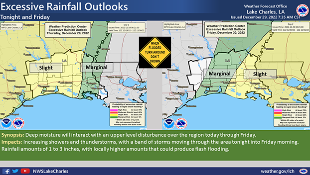
One to three inches of rain is possible along with locally higher amounts.
This could result in flooding of urban and low lying areas, and increase river levels.
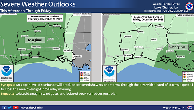
The main threats with any severe storms will be isolated damaging wind gusts and isolated weak tornadoes.
The entire area has the potential to see hazardous weather.
The Excessive Rainfall threat begins Thursday afternoon, with the greatest likelihood overnight into Friday morning, as a line of storms moves through the area.
The Severe Weather threat is from Thursday afternoon and evening across Southeast Texas, then shifts east into Louisiana overnight into Friday morning.


